GeoVision helps AEC and MEP professionals and students visualize their data by installing GeoVision plugins and connecting to the cloud. You can present your designs in person without lag, share them online instantly, or collaborate with your team on the same project. All of this is supported by fast, high-quality 3D visualization every step of the way.
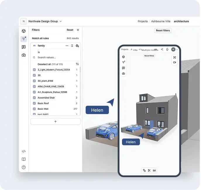
Work on Your Preferred Device, On the Go!
Need to share a design quickly? GeoVision is here for you. Access your work on any device and get instant feedback, wherever you are.
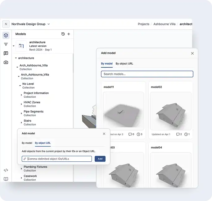
Infinite Versioning
All the data you upload to the cloud is stored as model versions, with easy access to the most recent version or previous ones, all clearly dated. This is how you can add different model versions to the 3D viewer.
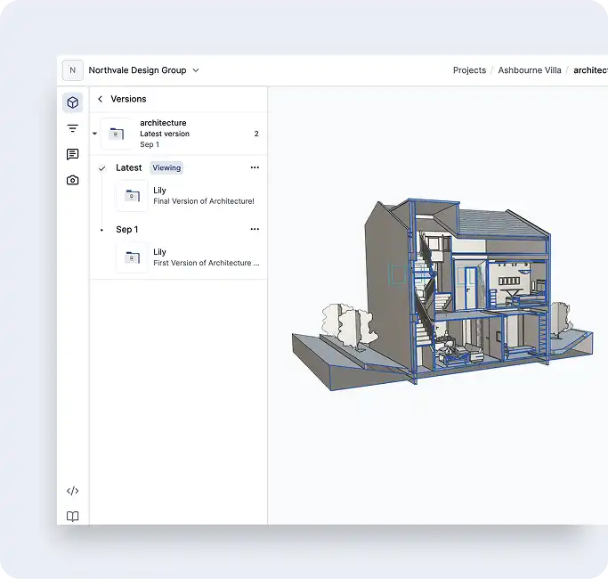
Track Changes Easily
Monitor the progress of your projects with GeoVision. Compare two model versions to identify what’s unchanged, modified, added, or removed.