
This guide is your go-to resource for a general understanding of GeoVision Cloud, how to set up workspaces, projects, and plugins.
What is GeoVision?
GeoVision is a fast, high-quality BIM visualization and collaboration platform available for AEC and MEP professionals and students. It allows users to access high-quality visualizations of their designs and showcase them anytime, anywhere.
Instead of relying on file-based workflows, GeoVision connects your design software to the cloud through lightweight plugins. This enables a live connection between your CAD/BIM tools and the cloud, so you’re sharing data, not files.
With GeoVision, you can visualize 3D models faster, track changes more clearly, and collaborate more effectively with your team
Why Use GeoVision?
Built for AEC Visualization
GeoVision addresses the pain point of complex AEC data visualization accessibility. It handles geometry, metadata, version history, and relationships between elements, all without flattening the data or losing meaning, in less time and with higher quality.
Anytime, Anywhere
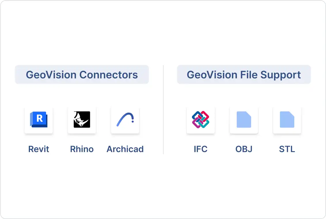
GeoVision connects your favorite tools, like Revit, Rhino, and Archicad, to the cloud so you can upload data and visualize it on any device without requiring others to download software to view your designs. GeoVision improves collaboration.
Collaborate Online
GeoVision brings your models to life on the web, making it easy to share, view, and discuss. You can upload designs from different software, track changes, leave comments directly on the models, and follow teammates to discuss a 3D representation of the building to come.
How GeoVision Works
GeoVision works without files to unlock your models from proprietary formats and desktop storage.
To do this, GeoVision relies on a set of integrations called plugins. These are lightweight plugins that integrate directly into the software you already use, such as Revit, Rhino, and Archicad.
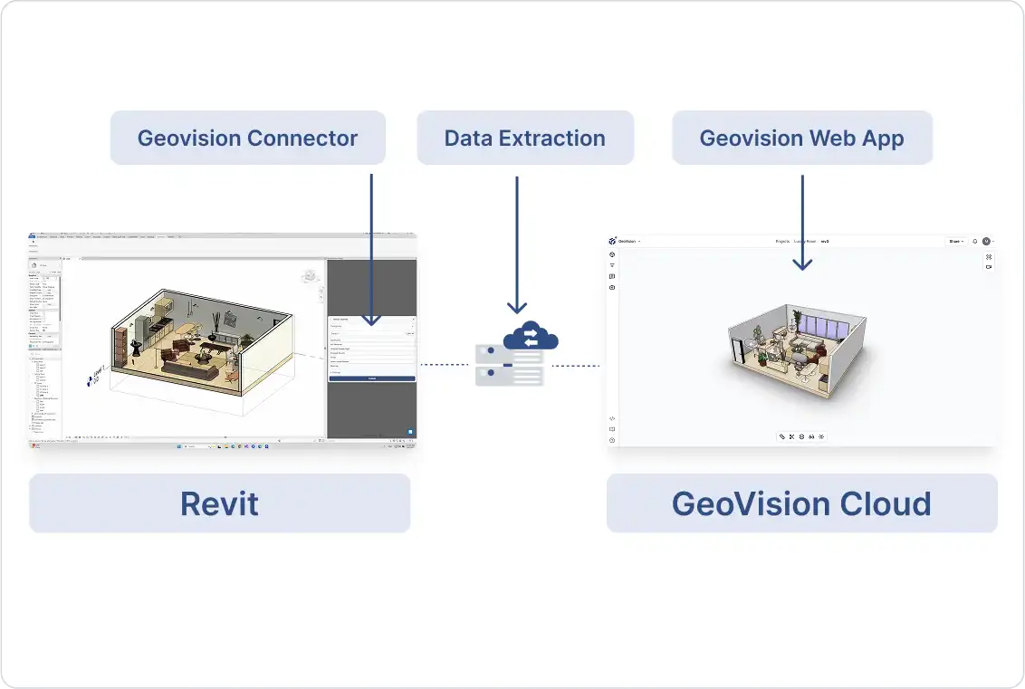
Plugins upload your models to GeoVision without relying on files; every piece of geometry or metadata is extracted and uploaded. Once your models are uploaded to GeoVision, they are stored securely in our cloud. GeoVision also supports drag-and-drop file uploads for formats like IFC, OBJ, and STL directly in the web app.
What You Can Do With GeoVision
Visualize and Collaborate on Models
Use the online 3D viewer to showcase your designs to others in person or share interactive models via link or embed. It’s ideal for model reviews, with features like version history, real-time follow mode, model federation, and 3D comments pinned to objects.
Store and Future-Proof
Keep all your designs in a secure, transparent cloud. You own your data; our platform simply hosts it.
Next Steps
1. Get started: Head to the Quickstart guide to set up your first workspace and project.
2. Explore tutorials: Visit our Tutorials page for workflow example videos.
Welcome to GeoVision, let’s dive in and bring your visions to life.